In this series of articles, we will take you through the process of geophysical interpretation from seismic acquisition to target definition. Today’s theme is seismic data acquisition results.
Swiss Geo Energy completed in October 2023 a pioneering and innovative 3D seismic acquisition project for geothermal exploration. The objective of data acquisition is to identify reservoir targets, estimate the geothermal resources, and design wells for operating the first combined heat and power geothermal plant in Switzerland.
Swiss Geo Energy, supported by Ad Terra Consultancy’s teams, designed a 104 km2 3D seismic survey for fast execution from the license award to delivering a high-quality broadband dataset with deep penetration and high vertical and horizontal resolution.
Our team adjusted the theoretical survey layout to the field conditions and made significant adjustments to place seismic sources and receivers optimally. Special layout modelling was implemented to avoid physical obstacles in the area (lakes, quarries, steep hills, cultivated lands, no-permit zones, etc.) and minimise the impact of operations in this environmentally sensitive area. Figure 1 below shows the evolution of the design from the initial theoretical approach to the field implementation.

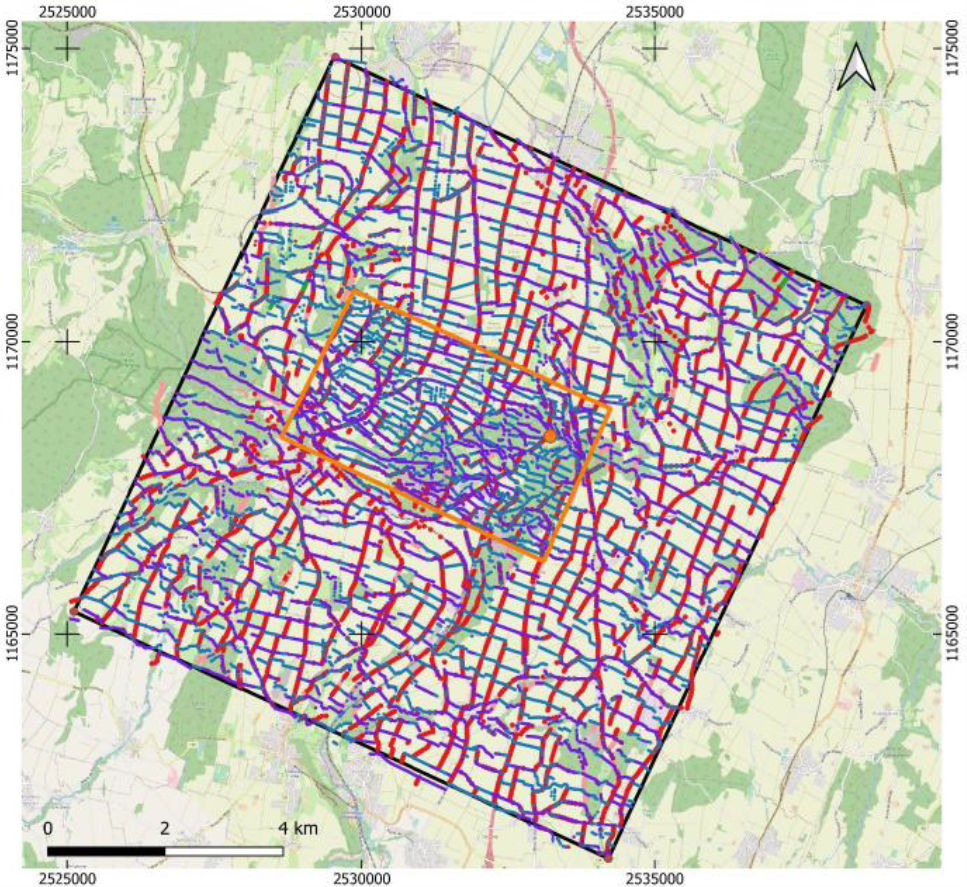
Figure 1: Left -theoretical survey design. Right-actual field implementation of the survey design. Red dots represent the source points, while blue dots represent the receiver points.
Our main objective was to adapt to the operational constraints without jeopardizing the data quality. Fold coverage maps were calculated and revised frequently while the acquisition was ongoing, and sources and receivers were added where necessary to compensate for the loss of coverage during permitting.
The diligent survey design allowed the acquisition of a high-resolution seismic dataset quickly with low project costs, low environmental impact, and minimal local disturbance.
SGE completed one of the world’s densest 3D nodal geothermal seismic surveys with 2 million traces/km2 density.
A few other figures highlight the campaign’s excellent results:
- Eleven nights of acquisition with four fleets, each comprised of one vibrating truck rotating in their respective quadrant at a 2500 m minimum distance from each other to avoid interferences,
- 13 500 vibrating points in total, whose energy level was adjusted depending on the distance to buildings as per Swiss regulation,
- 21 250 receiver stations deployed, and 99% of the data was recovered, thanks to minimal equipment degradation.
As a result, SGE obtained the final fold map, achieving 90% of the initial seismic acquisition design overall (Figure 2 shows the central area or the permit).

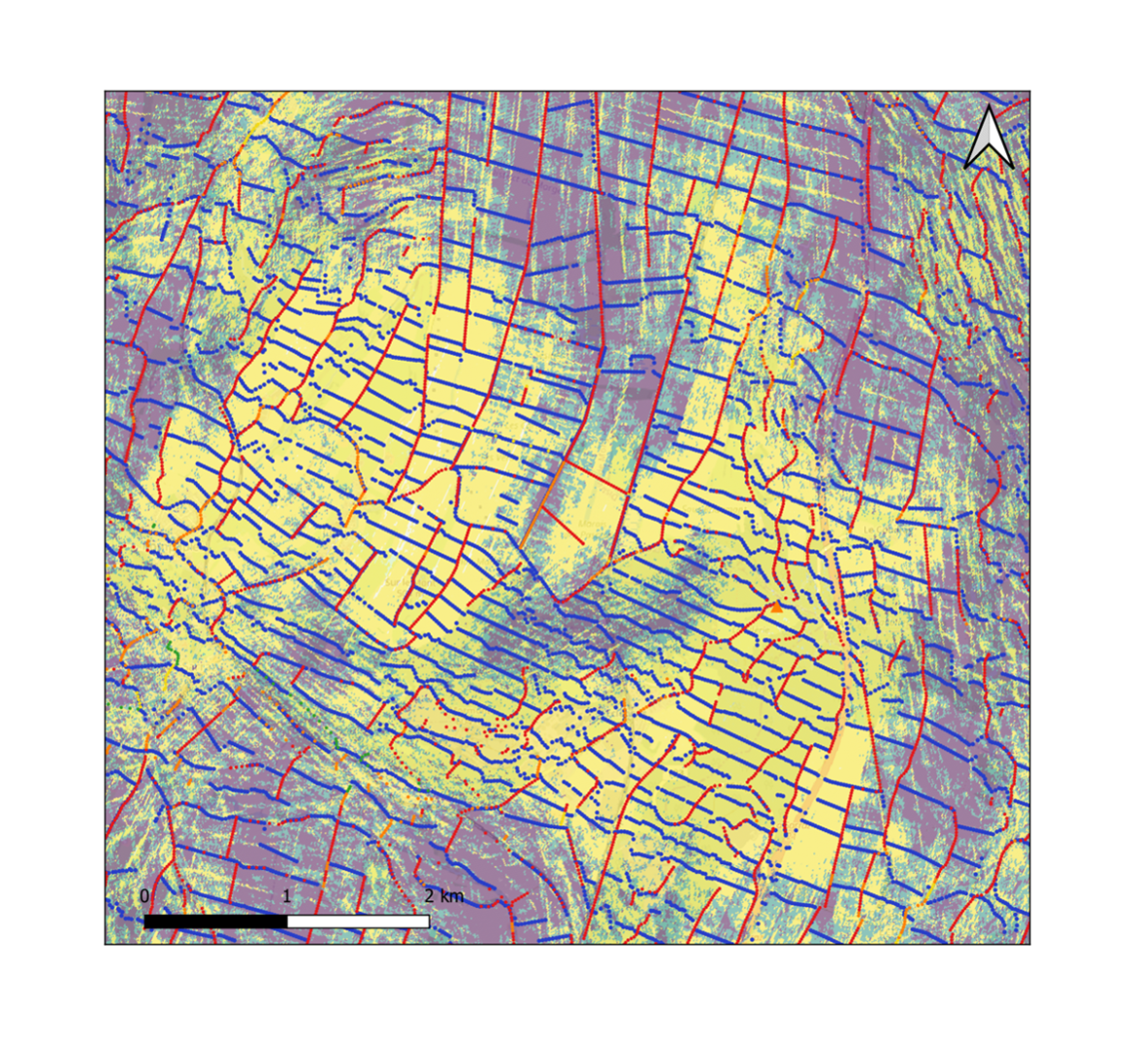
Figure 2: Left-theoretical survey design in the central area of the permit (red—source positions, blue—receiver positions). The fold map in the centre is larger due to the denser receiver layout.
Right—Postplot in the same area (actual field implementation) of the survey design. The fold man in the background shows high (yellow) and low (green) coverage areas.
SGE will now process the data acquired in an irregular grid to extract the best subsurface image. Leading-edge seismic processing and imaging technologies are currently applied to generate the optimal image of the subsurface for future geothermal well placement in the Eclépens area.
SGE expresses its gratitude to Ad Terra Consultancy and GEO2X technical teams who were instrumental in designing, optimising, planning and executing this campaign.
As we navigate our exploration journey, from the initial seismic acquisition to the final stage of a target definition, we will continue to publish concise articles on the topic. Next month, we plan to dedicate one to the intricacies of imaging processing. Make sure to visit our website to understand our work better.